
We see reality in data. Without compromise.
Precise 3D data with LiDAR — from flight to deliverables ready for your CAD, GIS or BIM workflow.
Accuracy
mm–cm
Outputs
LAS · BIM · GIS
Terrain
under vegetation too
Technology
What is LiDAR
Active laser measurement for dense 3D models of reality — for projects where precision matters.
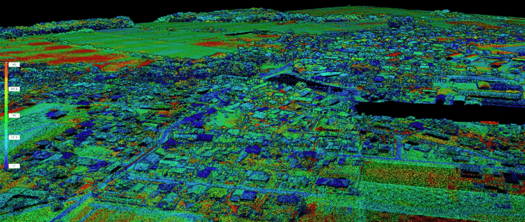
LiDAR (Light Detection and Ranging) is active laser range measurement. The sensor emits light pulses, measures returns and millions of points form a dense point cloud — an accurate 3D representation of reality.
Unlike photogrammetry alone, LiDAR delivers stable millimetre-to-centimetre accuracy regardless of surface texture and lighting. The result is ready for analysis, documentation and decisions.
Laser signal partially penetrates vegetation — capturing terrain under tree canopies where image-only data falls short. Essential for landscape planning, utility corridors and green monitoring.
- Laser scanning on ground and from UAV
- Dense point cloud with controlled accuracy
- Vegetation penetration and better terrain coverage
- Calibration and accuracy control for your project
Use cases
Application segments
From high-rises to landscape units — same data precision, different interpretation.
Construction
Progress monitoring, geometry checks, deliverables for designers and investors.
Landscape
Terrain, vegetation and catchment models for planning and ecology.
Heritage
Object documentation for restoration, conservation and presentation.
Infrastructure
Corridors, bridges, roads — precise placement in maps and BIM.
Hydrology
DTM/DSM for flood, runoff and drainage models.
Monitoring
Repeat flights to track change over time.
Value
Why LiDAR
Four reasons LiDAR is often the smartest choice for 3D field data.
Accuracy
Controlled measurement accuracy per project — from quick overviews to mm level.
Under vegetation
Better terrain coverage where visual methods alone are not enough.
Speed
Large areas in short time — suited to tight deadlines.
Compatibility
Outputs for GIS, CAD and BIM — no lock-in to one format.
Deliverables
Outputs and data
From raw point cloud to analytical models — aligned with project phase and agreement.
Core deliverables
- Point cloud (LAS / LAZ / E57)
- DTM / DSM
- Orthophoto
- Georeferenced extracts
Advanced deliverables
- Mesh / 3D models
- Sections and profiles
- Volumes and slopes
- Point classification (ground, vegetation, buildings)
Tailored
Custom data
We do not deliver a generic output you must rework. We agree format, coordinate systems and detail level so data fits your CAD, GIS or visualisation tool.
- CAD / BIM — layers, references, tolerances
- GIS — services, tiles, attributes
- Potree / web — lightweight online point cloud viewing
- Data optimisation — decimation, tiling, noise filtering
Engagement models
Service packages
Indicative structure — final scope always depends on site and target accuracy.
Pro
Most common choice for projects
- ✓Higher density
- ✓DTM + DSM
- ✓Classification
- ✓CAD / GIS export
Enterprise
Maximum detail and analytics
- ✓Max detail
- ✓Mesh
- ✓Analytics
- ✓BIM
- ✓Online visualisation
Combined technologies
LiDAR above ground. GPR below ground.
LiDAR excels at precise 3D surfaces and objects above ground. Where you need subsurface information — cables, utilities, voids, archaeology — we add ground-penetrating radar (GPR). Together you get above-and-below context for safer decisions.
- Detection of underground utilities and anomalies
- Baseline data for excavation pits
- Archaeology and protection zones

HORDRONES
We do not just deliver data. We deliver solutions.
From first consultation to final deliverables — one quality standard throughout.
Contact us